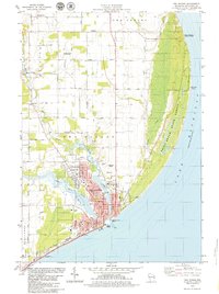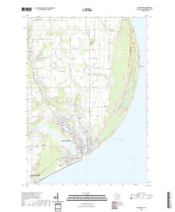
2022 Map of Two Rivers
USGS Topo · Published 2022About this map
The convergence of the East Twin River and West Twin River at Two Rivers defines this coastal landscape along Lake Michigan. This 2022 survey illustrates the modern layout of the city and its surrounding rural townships, including the northern reaches of Manitowoc and the village of Mishicot to the northwest. The map is a valuable resource for local historians tracing the area's spiritual and civic foundations, with several well-established burial grounds including Saxonburg Cem, Tannery Cem, and Forest View Cem.
Find a feature on this map
107 named features on this map. Tap any name to fly to it.
Don’t see what you’re looking for? This feature index may not catch every label — zoom into the map to look around manually.
Map Details
Editions of this 2022 Two Rivers Map
This is the sole edition of this map. No revisions or reprints were ever made.