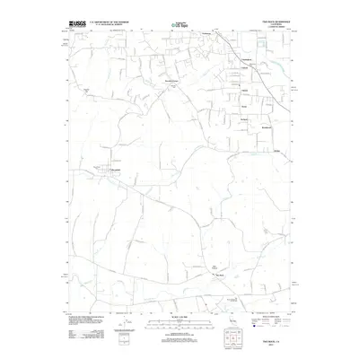
2012 Map of Two Rock
USGS Topo · Published 2012About this map
Stemple Cr and Americano Cr wind through this agricultural landscape in southwestern Sonoma County, reflecting a rural character that persists into the early 21st century. The map centers on the small settlement of Bloomfield, historically a significant crossroads, and Two Rock to the southeast. The distribution of small community hubs like Hessel, Cunningham, and Knowles Corner indicates a territory organized around family farming and local service centers rather than dense urbanization. Local heritage is deeply rooted in these lands, evidenced by numerous burial sites including the Two Rock Presbyterian Church Cem, Macedonia Cem, and Canfield Cem. Topographically, English Hill stands as a prominent landmark in the northwest, while the southeastern corner is defined by the headwaters of the Laguna de Santa Rosa.
Find a feature on this map
109 named features on this map. Tap any name to fly to it.
Don’t see what you’re looking for? This feature index may not catch every label — zoom into the map to look around manually.
Map Details
Editions of this 2012 Two Rock Map
This is the sole edition of this map. No revisions or reprints were ever made.
Other maps of this area

1914 · Petaluma
USGS Topo · 1:62,500

1916 · Santa Rosa
USGS Topo · 1:62,500

1916 · Point Reyes
USGS Topo · 1:48,000

1918 · Point Reyes
USGS Topo · 1:62,500

1935 · Sebastopol
USGS Topo · 1:48,000

1942 · Sebastopol
USGS Topo · 1:62,500

1942 · Petaluma
USGS Topo · 1:62,500

1944 · Santa Rosa
USGS Topo · 1:62,500

1947 · Santa Rosa
USGS Topo · 1:250,000

1949 · Santa Rosa
USGS Topo · 1:250,000