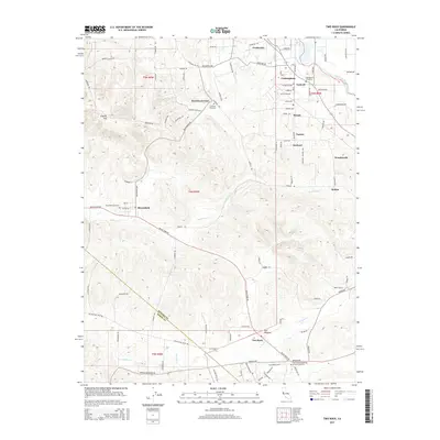
2015 Map of Two Rock
USGS Topo · Published 2015About this map
English Hill rises above the rolling agricultural landscape west of Santa Rosa, where a network of small creeks like Americano Cr and Stemple Cr drain toward the coast. This rural portion of Sonoma County is defined by a dense web of long-standing family roads and small communities that have served the region's dairy and ranching history for generations. The map reveals the layout of historic settlements such as Bloomfield, Cunningham, and Two Rock, which remain centers of local identity.
Find a feature on this map
101 named features on this map. Tap any name to fly to it.
Don’t see what you’re looking for? This feature index may not catch every label — zoom into the map to look around manually.
Map Details
Editions of this 2015 Two Rock Map
This is the sole edition of this map. No revisions or reprints were ever made.
Other maps of this area

1914 · Petaluma
USGS Topo · 1:62,500

1916 · Santa Rosa
USGS Topo · 1:62,500

1916 · Point Reyes
USGS Topo · 1:48,000

1918 · Point Reyes
USGS Topo · 1:62,500

1935 · Sebastopol
USGS Topo · 1:48,000

1942 · Sebastopol
USGS Topo · 1:62,500

1942 · Petaluma
USGS Topo · 1:62,500

1944 · Santa Rosa
USGS Topo · 1:62,500

1947 · Santa Rosa
USGS Topo · 1:250,000

1949 · Santa Rosa
USGS Topo · 1:250,000