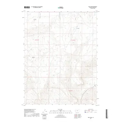
2019 Map of Two V Basin
USGS Topo · Published 2019About this map
Piñon Mesa anchors this high-elevation landscape in Mesa County, where deep incisions and broad basins characterize the terrain. The namesake Two V Basin and nearby Lost Horse Basin indicate a geography shaped by drainage patterns that feed into numerous canyons and draws. Waterways such as Granite Cr, Coates Cr, and Bieser Cr flow through the northern reaches, while the southern portion is dominated by the dramatic descent into Uncompahgre Canyon and the expansive Bull Draw. The 2019 survey shows very light infrastructure, primarily rural routes like MS RD and S 7/10 RD, reflecting a region largely defined by its natural topography rather than dense settlement. The map serves as a detailed record of land divisions, including t14s r104w and t14s r103w, highlighting the intersection of public land management and the western Colorado landscape.
Find a feature on this map
21 named features on this map. Tap any name to fly to it.
Don’t see what you’re looking for? This feature index may not catch every label — zoom into the map to look around manually.
Map Details
Editions of this 2019 Two V Basin Map
This is the sole edition of this map. No revisions or reprints were ever made.
Other maps of this area

1885 · La Sal
USGS Topo · 1:250,000

1949 · Gateway
USGS Topo · 1:24,000

1950 · Pine Mountain
USGS Topo · 1:24,000

1952 · Gateway
USGS Topo · 1:24,000

1954 · Mt. Waas 4 NE
USGS Topo · 1:24,000

1954 · Mt. Waas 1 NE
USGS Topo · 1:24,000

1954 · Mt. Waas 1 SE
USGS Topo · 1:24,000

1954 · Coates Creek
USGS Topo · 1:62,500

1954 · Polar Mesa
USGS Topo · 1:62,500

1956 · Moab
USGS Topo · 1:250,000