
1968 Map of Tybo
USGS Topo · Published 1970About this map
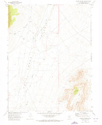
The Hot Creek Range dominates this late-1960s survey, revealing a landscape defined by isolated mining operations and Cold War-era federal activity in Nye County. The small settlement of Tybo sits tucked into Tybo Canyon, accompanied by a nearby Cem and evidence of older industry like the Charcoal Kilns. The map highlights the area's transition from traditional resource extraction, seen at the Old Dominion Mine and Keystone (Site), to mid-century scientific research at the Central Nevada Test Site Base Camp. To the east, the vast flats of Hot Creek Valley are marked by remote wells and a solitary Landing Strip. Significant landmarks such as Twin Peaks Amethyst Peak and Flagstaff Mtn overlook a complex network of canyons and springs that sustained early ranching and prospecting in this arid interior basin.
Find a feature on this map
60 named features on this map. Tap any name to fly to it.
Don’t see what you’re looking for? This feature index may not catch every label — zoom into the map to look around manually.
Map Details
Editions of this 1968 Tybo Map
This is the sole edition of this map. No revisions or reprints were ever made.
Other maps of this area

1956 · Tonopah
USGS Topo · 1:250,000

1959 · Tonopah
USGS Topo · 1:250,000

1962 · Tonopah
USGS Topo · 1:250,000

1967 · Lunar Crater
USGS Topo · 1:62,500

1967 · Moores Station
USGS Topo · 1:62,500

1967 · Blue Jay Spring
USGS Topo · 1:24,000

1967 · Buckwheat Rim
USGS Topo · 1:24,000

1967 · Palisade Mesa
USGS Topo · 1:24,000

1967 · Tybo SE
USGS Topo · 1:24,000
1967 · Moores Station SW
USGS Topo · 1:24,000