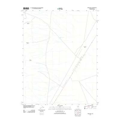
2012 Map of Tybo Well
USGS Topo · Published 2012About this map
Hot Creek Valley dominates this arid landscape in central Nevada, where drainage patterns define the geography. The presence of Tybo Well suggests a critical water point for ranching or traveler support in this sparse portion of Nye County. To the west, the terrain rises into several distinct drainages including Fairbanks Canyon, Red Rock Canyon, and Music Canyon, all of which feed into the broader valley system. Tybo Creek marks the northern edge of this area, illustrating the seasonal water flows that have shaped the canyons. The map documents the high-desert infrastructure of the early 21st century, showing how modern roads and traditional landmarks like named wells continue to coexist in this remote Basin and Range territory.
Find a feature on this map
6 named features on this map. Tap any name to fly to it.
Don’t see what you’re looking for? This feature index may not catch every label — zoom into the map to look around manually.
Map Details
Editions of this 2012 Tybo Well Map
This is the sole edition of this map. No revisions or reprints were ever made.
Other maps of this area

1956 · Tonopah
USGS Topo · 1:250,000

1959 · Tonopah
USGS Topo · 1:250,000

1962 · Tonopah
USGS Topo · 1:250,000

1967 · Lunar Crater
USGS Topo · 1:62,500

1967 · Blue Jay Spring
USGS Topo · 1:24,000

1967 · Buckwheat Rim
USGS Topo · 1:24,000

1967 · Palisade Mesa
USGS Topo · 1:24,000

1967 · Tybo SE
USGS Topo · 1:24,000

1968 · Tybo
USGS Topo · 1:62,500

1968 · Warm Springs
USGS Topo · 1:62,500