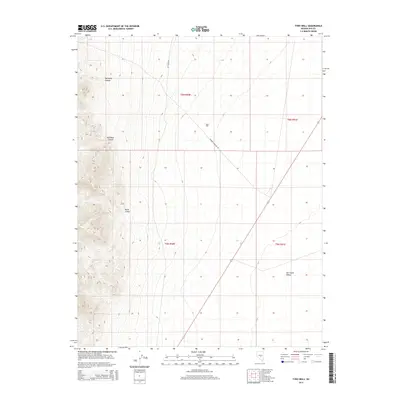
2014 Map of Tybo Well
USGS Topo · Published 2014About this map
Tybo Well serves as a critical water point in this high-desert basin of Nye County, where the stark topography of the Hot Creek Range meets the broad expanse of Hot Creek Valley. The terrain is defined by deep incisions like Fairbanks Canyon, Red Rock Canyon, and Music Canyon, which channel seasonal runoff toward the valley floor. Transportation across this arid landscape relies on the established routes of Hot Creek Rd and Toiyabe Basecamp Rd, which link the high country to the valley's lower elevations. The mapping reflects the enduring structure of the public land survey system, clearly delineated by the township and range boundaries of t6n r50e and t5n r51e. This 2014 survey documents the geographic relationship between the rugged western canyons and the cattle-and-mining infrastructure that historically supported the region's scattered inhabitants.
Find a feature on this map
11 named features on this map. Tap any name to fly to it.
Don’t see what you’re looking for? This feature index may not catch every label — zoom into the map to look around manually.
Map Details
Editions of this 2014 Tybo Well Map
This is the sole edition of this map. No revisions or reprints were ever made.
Other maps of this area

1956 · Tonopah
USGS Topo · 1:250,000

1959 · Tonopah
USGS Topo · 1:250,000

1962 · Tonopah
USGS Topo · 1:250,000

1967 · Lunar Crater
USGS Topo · 1:62,500

1967 · Blue Jay Spring
USGS Topo · 1:24,000

1967 · Buckwheat Rim
USGS Topo · 1:24,000

1967 · Palisade Mesa
USGS Topo · 1:24,000

1967 · Tybo SE
USGS Topo · 1:24,000

1968 · Tybo
USGS Topo · 1:62,500

1968 · Warm Springs
USGS Topo · 1:62,500