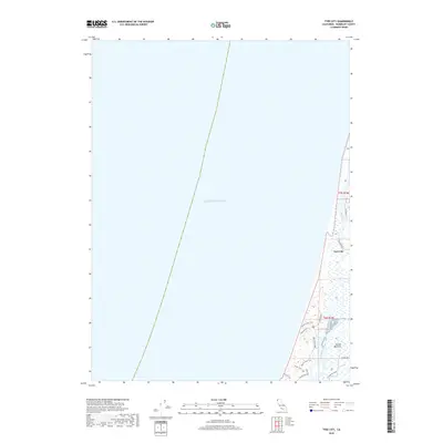
2018 Map of Tyee City
USGS Topo · Published 2018About this map
The Tyee City settlement sits on a thin strip of land between the Pacific Ocean and the meandering path of the Mad River. This coastal environment in Humboldt County is defined by the shifting interface of freshwater and saltwater, where the river runs parallel to the shore before finally meeting the sea. To the south, the Arcata Bottoms represent a transition into low-lying coastal plains, crisscrossed by drainage features like Liscom-Slu and the Mad River Slough.
Find a feature on this map
20 named features on this map. Tap any name to fly to it.
Don’t see what you’re looking for? This feature index may not catch every label — zoom into the map to look around manually.
Map Details
Editions of this 2018 Tyee City Map
This is the sole edition of this map. No revisions or reprints were ever made.
Other maps of this area

1922 · Eureka
USGS Topo · 1:62,500

1933 · Eureka
USGS Topo · 1:48,000

1942 · Eureka
USGS Topo · 1:62,500

1945 · Trinidad
USGS Topo · 1:62,500

1949 · Eureka
USGS Topo · 1:250,000

1951 · Eureka
USGS Topo · 1:62,500
1952 · Trinidad
USGS Topo · 1:62,500
1952 · Arcata North
USGS Topo · 1:24,000
1958 · Eureka
USGS Topo · 1:24,000

1958 · Eureka
USGS Topo · 1:250,000