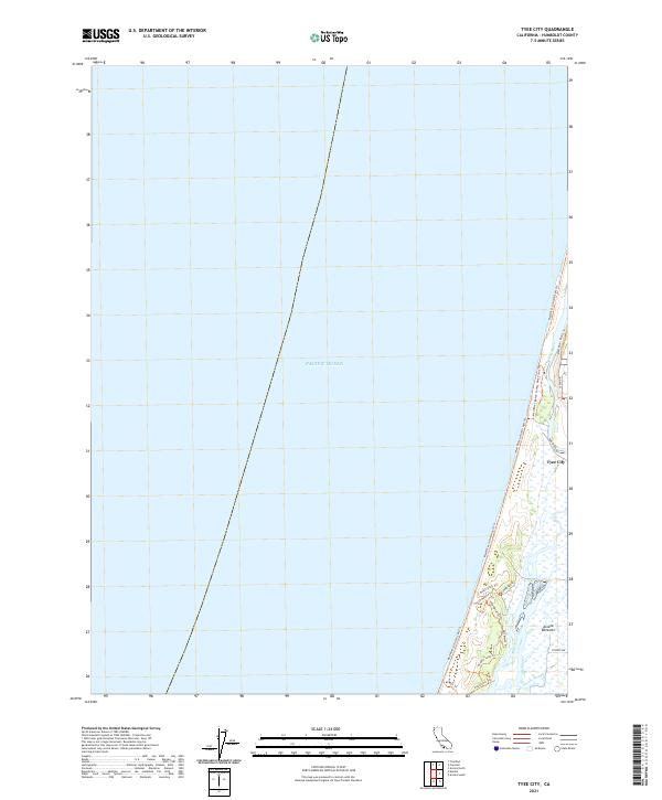
2021 Map of Tyee City
USGS Topo · Published 2021About this map
Tyee City and the surrounding Arcata Bottoms landscape define this coastal section of Humboldt County. The map details the intricate network of water and wetlands where Mad River Slough and Liscom Slough meet the shifting shoreline of the Pacific Ocean. This area is characterized by a high concentration of recreational and access paths, including the extensive Mad River to North Spit Trl and the Mad River Beach County Park Trails Trl, reflecting the contemporary focus on coastal preservation and public use. Inland, roads like Lanphere Rd and Mad River Rd provide access to the low-lying agricultural and marshy terrain that sits just behind the protective dunes. The layout of these trails, such as the Beach Loop Trl and South Hollow Trl, underscores the complex geography of the north spit and its ecological importance.
Find a feature on this map
21 named features on this map. Tap any name to fly to it.
Don’t see what you’re looking for? This feature index may not catch every label — zoom into the map to look around manually.
Map Details
Editions of this 2021 Tyee City Map
This is the sole edition of this map. No revisions or reprints were ever made.
Other maps of this area

1922 · Eureka
USGS Topo · 1:62,500

1933 · Eureka
USGS Topo · 1:48,000

1942 · Eureka
USGS Topo · 1:62,500

1945 · Trinidad
USGS Topo · 1:62,500

1949 · Eureka
USGS Topo · 1:250,000

1951 · Eureka
USGS Topo · 1:62,500
1952 · Trinidad
USGS Topo · 1:62,500
1952 · Arcata North
USGS Topo · 1:24,000
1958 · Eureka
USGS Topo · 1:24,000

1958 · Eureka
USGS Topo · 1:250,000