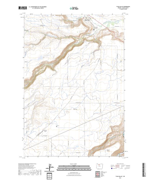
2024 Map of Tygh Valley
USGS Topo · Published 2024About this map
Juniper Flat dominates the high plateau of this Wasco County landscape, where the agricultural transition between the desert and the river canyons is clearly defined. The settlement of Tygh Valley sits at the confluence of Tygh Creek and the White River, a location historically significant for its water access and proximity to the White Wild and Scenic River corridor. The map reveals a network of land-use history, from the Independent Order of Odd Fellows Cem and Kelly Cem to the critical irrigation infrastructure of the Wapinitia Canal. To the south, the community of Wapinitia is served by the small Wapinitia Airport, illustrating the rural transportation patterns that persist across this arid terrain. Extensive family-named roads like Val Miller Rd and Earl Crabtree Rd trace the property boundaries of the Natural Pasture and larger ranching operations found throughout the region.
Find a feature on this map
44 named features on this map. Tap any name to fly to it.
Don’t see what you’re looking for? This feature index may not catch every label — zoom into the map to look around manually.
Map Details
Editions of this 2024 Tygh Valley Map
This is the sole edition of this map. No revisions or reprints were ever made.
Other maps of this area

1930 · Dufur
USGS Topo · 1:125,000

1934 · Dufur
USGS Topo · 1:125,000

1953 · The Dalles
USGS Topo · 1:250,000

1956 · The Dalles
USGS Topo · 1:250,000

1957 · The Dalles
USGS Topo · 1:250,000

1962 · Sherars Bridge
USGS Topo · 1:24,000

1962 · Postage Stamp Butte
USGS Topo · 1:24,000
1962 · Dant
USGS Topo · 1:24,000

1962 · Wamic
USGS Topo · 1:24,000
1962 · Wapinitia
USGS Topo · 1:24,000