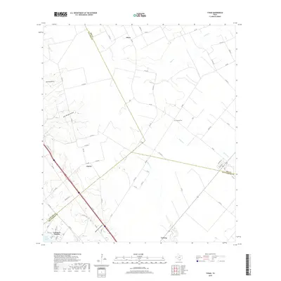
2019 Map of Tynan
USGS Topo · Published 2019About this map
Argenta and Vahlsing anchor this rural Texas landscape where the boundaries of Bee, Live Oak, and San Patricio counties converge. The terrain is defined by a series of distinct drainages and named depressions, including Mustang Hollow, Rufe Williams Hollow, and Jack Green Hollow, which direct runoff toward local waterways like Olmos Cr and Papalote Cr. To the southwest, the shoreline of Lake Corpus Christi meets the residential pocket of Lakeshore Gardens, marking the transition from agricultural brushland to lakeside development.
Find a feature on this map
59 named features on this map. Tap any name to fly to it.
Don’t see what you’re looking for? This feature index may not catch every label — zoom into the map to look around manually.
Map Details
Editions of this 2019 Tynan Map
This is the sole edition of this map. No revisions or reprints were ever made.
Other maps of this area

1925 · Mathis No. 2
USGS Topo · 1:48,000

1925 · Mathis No. 3
USGS Topo · 1:48,000

1927 · Mathis
USGS Topo · 1:62,500

1953 · Beeville
USGS Topo · 1:250,000

1954 · Skidmore
USGS Topo · 1:62,500

1954 · Fleming
USGS Topo · 1:62,500

1954 · Mathis
USGS Topo · 1:62,500

1954 · Sinton
USGS Topo · 1:62,500

1956 · Beeville
USGS Topo · 1:250,000

1960 · Beeville
USGS Topo · 1:250,000