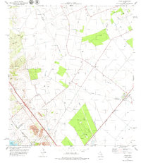
1979 Map of Tynan
USGS Topo · Published 1979About this map
The South Texas landscape near the junction of Bee, San Patricio, and Live Oak Counties is defined by the intersection of rural agriculture and early energy infrastructure. In the late 1970s, the small community of Tynan serves as a local hub near the southern edge of the Bee County line, while smaller settlements like Argenta and Heldenfels anchor the surrounding ranch lands. This period shows a complex web of pipelines and oil and gas wells crisscrossing the terrain between Olmos Creek and Papalote Creek. Transportation is dominated by the parallel routes of the Southern Pacific and Missouri Pacific railroads, which once facilitated the movement of goods and cattle. Historical markers such as Waldheim Cem and Argenta Cem provide critical touchpoints for genealogists, while the reach of Lake Corpus Christi in the southwest corner indicates the regional importance of water management in this arid stretch of the coastal plain.
Find a feature on this map
26 named features on this map. Tap any name to fly to it.
Don’t see what you’re looking for? This feature index may not catch every label — zoom into the map to look around manually.
Map Details
Editions of this 1979 Tynan Map
This is the sole edition of this map. No revisions or reprints were ever made.
Other maps of this area

1925 · Mathis No. 2
USGS Topo · 1:48,000

1925 · Mathis No. 3
USGS Topo · 1:48,000

1927 · Mathis
USGS Topo · 1:62,500

1953 · Beeville
USGS Topo · 1:250,000

1954 · Skidmore
USGS Topo · 1:62,500

1954 · Fleming
USGS Topo · 1:62,500

1954 · Mathis
USGS Topo · 1:62,500

1954 · Sinton
USGS Topo · 1:62,500

1956 · Beeville
USGS Topo · 1:250,000

1960 · Beeville
USGS Topo · 1:250,000