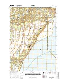
2016 Map of Tyonek A-3 NW
USGS Topo · Published 2016About this map
The Beluga River dominates the northern reaches of this coastal landscape, winding through wetlands toward the Pacific Ocean. As a snapshot of the region in 2016, the map reveals a small network of infrastructure clustered between the river and Cottonwood Beach, marking the transition from the wild terrain of the Matanuska-Susitna Borough and Kenai Peninsula Borough border. The Beluga Highway serves as the primary artery, connecting the Beluga Airport to localized residential developments.
Find a feature on this map
17 named features on this map. Tap any name to fly to it.
Don’t see what you’re looking for? This feature index may not catch every label — zoom into the map to look around manually.
Map Details
Editions of this 2016 Tyonek A-3 NW Map
This is the sole edition of this map. No revisions or reprints were ever made.
Other maps of this area

1949 · Tyonek
USGS Topo · 1:250,000

1951 · Tyonek
USGS Topo · 1:250,000

1954 · Tyonek B-4
USGS Topo · 1:63,360

1958 · Tyonek B-3
USGS Topo · 1:63,360

1958 · Tyonek A-4
USGS Topo · 1:63,360
1958 · Tyonek A-3
USGS Topo · 1:63,360

1958 · Tyonek
USGS Topo · 1:250,000

1965 · Tyonek
USGS Topo · 1:250,000
2013 · Tyonek B-3 SW
USGS Topo · 1:25,000
2013 · Tyonek A-3 NE
USGS Topo · 1:25,000