
1958 Map of Tyonek B-3
USGS Topo · Published 1961About this map
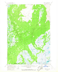
Theodore River and the Lewis River flow through this expansive coastal landscape in the late 1950s, revealing a region defined by its waterway networks and seasonal access points. The presence of a Winter Landing Strip and isolated outposts like Grant's Cabin underscore the remote nature of the terrain during this era, where travel was dictated by the freeze and thaw of the Alaskian wilderness. To the south, the Chedatna Lakes and the Beluga River drainage system dominate the lowlands, while smaller tributaries such as Pretty Creek and Olson Creek branch through the timbered flats. The map also captures a solitary Mine and Wolverine Creek in the northern reaches, providing a clear record of the early industrial and subsistence-based footprint in the area before more modern development reached these shores.
Find a feature on this map
15 named features on this map. Tap any name to fly to it.
Don’t see what you’re looking for? This feature index may not catch every label — zoom into the map to look around manually.
Map Details
Editions of this 1958 Tyonek B-3 Map
3 editions found
Other maps of this area

1949 · Tyonek
USGS Topo · 1:250,000

1951 · Tyonek
USGS Topo · 1:250,000

1951 · Tyonek A-2
USGS Topo · 1:63,360

1952 · Tyonek A-2
USGS Topo · 1:63,360

1954 · Tyonek C-4
USGS Topo · 1:63,360

1954 · Tyonek B-4
USGS Topo · 1:63,360

1954 · Tyonek C-3
USGS Topo · 1:63,360

1958 · Tyonek C-2
USGS Topo · 1:63,360

1958 · Tyonek A-4
USGS Topo · 1:63,360
1958 · Tyonek A-3
USGS Topo · 1:63,360