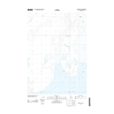
2013 Map of Tyonek B-2 SW
USGS Topo · Published 2013About this map
Susitna Delta and the intricate alluvial landscape where the Susitna River meets the Pacific Ocean define this survey of the northern Cook Inlet coastline. The terrain is a complex network of tidally influenced waterways and wetlands, including the extensive Beluga Slough and the Ivan River. The presence of Indigenous Dena'ina place names like Susni Kaq', Yach'ditnu, and Qalnigi Denuch'dnel'ushtnu provides critical cultural and geographic context for the Matanuska-Susitna region, marking traditional landmarks alongside major landforms like Big Island and Barrel Island. This 2013 data illustrates a dynamic coastal environment where freshwater systems like Fish Cr and Stump Lake integrate with the shifting silt and channels of the delta.
Find a feature on this map
17 named features on this map. Tap any name to fly to it.
Don’t see what you’re looking for? This feature index may not catch every label — zoom into the map to look around manually.
Map Details
Editions of this 2013 Tyonek B-2 SW Map
This is the sole edition of this map. No revisions or reprints were ever made.
Other maps of this area

1949 · Tyonek
USGS Topo · 1:250,000

1951 · Tyonek
USGS Topo · 1:250,000

1951 · Tyonek A-2
USGS Topo · 1:63,360

1952 · Tyonek A-2
USGS Topo · 1:63,360

1958 · Tyonek B-3
USGS Topo · 1:63,360
1958 · Tyonek A-3
USGS Topo · 1:63,360

1958 · Tyonek B-2
USGS Topo · 1:63,360

1958 · Tyonek
USGS Topo · 1:250,000

1965 · Tyonek
USGS Topo · 1:250,000
2013 · Tyonek A-3 NE
USGS Topo · 1:25,000