
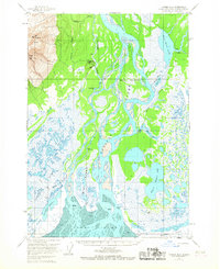
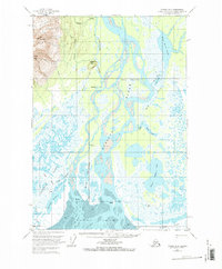
1958 Map of Tyonek B-2
USGS Topo · Published 1961About this map
Mt Susitna dominates the northwestern horizon of this coastal landscape, where the braided channels of the Susitna River meeting the tidal waters of Cook Inlet. The map documents a complex delta system characterized by massive landforms like Big Island and Bell Island, surrounded by a network of smaller waterways including Alexander Creek and Fish Creek. Small settlements and landmarks such as Dinglishna Hill, Alexander, and Pierce are situated along these vital water routes, indicating a period when river access was central to movement in the region.
Find a feature on this map
38 named features on this map. Tap any name to fly to it.
Don’t see what you’re looking for? This feature index may not catch every label — zoom into the map to look around manually.
Map Details
Editions of this 1958 Tyonek B-2 Map
3 editions found
Other maps of this area

1949 · Tyonek
USGS Topo · 1:250,000

1951 · Tyonek
USGS Topo · 1:250,000

1951 · Tyonek A-2
USGS Topo · 1:63,360

1951 · Tyonek A-1
USGS Topo · 1:63,360

1952 · Tyonek C-1
USGS Topo · 1:63,360

1952 · Tyonek A-2
USGS Topo · 1:63,360

1952 · Tyonek A-1
USGS Topo · 1:63,360

1954 · Tyonek C-3
USGS Topo · 1:63,360

1958 · Tyonek C-2
USGS Topo · 1:63,360

1958 · Tyonek B-1
USGS Topo · 1:63,360