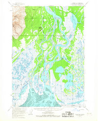
1958 Map of Tyonek B-2
USGS Topo · Published 1967About this map
The massive Susitna River delta dominates this landscape, branching into a complex network of channels and sloughs before reaching the Cook Inlet. Large landmasses like Big Island and Bell Island are defined by the shifting braided waters, surrounded by the expansive marshlands of the Susitna Flats. To the northwest, the terrain rises sharply toward Mt Susitna and South Peak, offering a stark contrast to the low-lying wetlands.
Find a feature on this map
37 named features on this map. Tap any name to fly to it.
Don’t see what you’re looking for? This feature index may not catch every label — zoom into the map to look around manually.
Map Details
Editions of this 1958 Tyonek B-2 Map
3 editions found

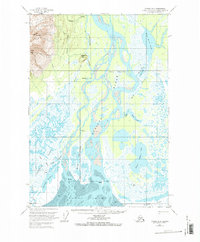
Other maps of this area

1949 · Tyonek
USGS Topo · 1:250,000

1951 · Tyonek
USGS Topo · 1:250,000

1951 · Tyonek A-2
USGS Topo · 1:63,360

1951 · Tyonek A-1
USGS Topo · 1:63,360

1952 · Tyonek C-1
USGS Topo · 1:63,360

1952 · Tyonek A-2
USGS Topo · 1:63,360

1952 · Tyonek A-1
USGS Topo · 1:63,360

1954 · Tyonek C-3
USGS Topo · 1:63,360

1958 · Tyonek C-2
USGS Topo · 1:63,360

1958 · Tyonek B-1
USGS Topo · 1:63,360