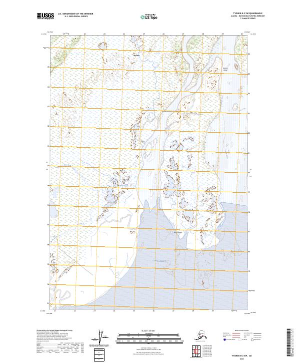
2023 Map of Tyonek B-2 SW
USGS Topo · Published 2023About this map
Cook Inlet dominates the southern reaches of this landscape, where tidal waters meet the sprawling drainage of the Susitna Valley. The environment is defined by a complex network of waterways, including the Susitna River, Ivan River, and the intricate Beluga Slough. This coastal wetland system creates distinct landforms such as Big Island and Barrel Island, which are situated within the shifting intertidal zones. The northern sections of the map are characterized by the vast alluvial deposits and marshes typical of the lower Susitna basin.
Find a feature on this map
18 named features on this map. Tap any name to fly to it.
Don’t see what you’re looking for? This feature index may not catch every label — zoom into the map to look around manually.
Map Details
Editions of this 2023 Tyonek B-2 SW Map
This is the sole edition of this map. No revisions or reprints were ever made.
Other maps of this area

1949 · Tyonek
USGS Topo · 1:250,000

1951 · Tyonek
USGS Topo · 1:250,000

1951 · Tyonek A-2
USGS Topo · 1:63,360

1952 · Tyonek A-2
USGS Topo · 1:63,360

1958 · Tyonek B-3
USGS Topo · 1:63,360
1958 · Tyonek A-3
USGS Topo · 1:63,360

1958 · Tyonek B-2
USGS Topo · 1:63,360

1958 · Tyonek
USGS Topo · 1:250,000

1965 · Tyonek
USGS Topo · 1:250,000
2013 · Tyonek A-3 NE
USGS Topo · 1:25,000