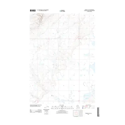
2013 Map of Tyonek B-3 SE
USGS Topo · Published 2013About this map
Grants Cabin stands as a solitary outpost in this intricate wetland landscape within the Matanuska-Susitna Borough. The 2013 survey reveals a complex hydrological network where the Theodore River and Lewis River meander through low-lying terrain before reaching the Lewis River Slough. To the east, the Ivan River parallels these watercourses, while the Chedatna Lakes cluster in the southeastern corner, illustrating the saturated character of the Alaskan coastal plain. Human infrastructure is minimal, represented primarily by the Beluga Hwy skirting the southern boundary, which provides the only major overland access through this transition between wilderness and the Cook Inlet drainage. The map provides a detailed record of the shifting river channels and seasonal water bodies that define navigation and subsistence in this remote region.
Find a feature on this map
10 named features on this map. Tap any name to fly to it.
Don’t see what you’re looking for? This feature index may not catch every label — zoom into the map to look around manually.
Map Details
Editions of this 2013 Tyonek B-3 SE Map
This is the sole edition of this map. No revisions or reprints were ever made.
Other maps of this area

1949 · Tyonek
USGS Topo · 1:250,000

1951 · Tyonek
USGS Topo · 1:250,000

1951 · Tyonek A-2
USGS Topo · 1:63,360

1952 · Tyonek A-2
USGS Topo · 1:63,360

1958 · Tyonek B-3
USGS Topo · 1:63,360
1958 · Tyonek A-3
USGS Topo · 1:63,360

1958 · Tyonek B-2
USGS Topo · 1:63,360

1958 · Tyonek
USGS Topo · 1:250,000

1965 · Tyonek
USGS Topo · 1:250,000
2013 · Tyonek B-3 SW
USGS Topo · 1:25,000