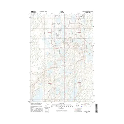
2016 Map of Tyonek C-1 NE
USGS Topo · Published 2016About this map
Willow Lake and the surrounding cluster of glacial kettles north of Nancy Lake define this portion of the Susitna Valley in the mid-2010s. The landscape is characterized by a dense network of small airstrips and lakeside residential developments, reflecting the area's role as a hub for general aviation and recreation. Distinctive features like the Minuteman Strip and Honeybee Lake Aero Park sit alongside established infrastructure like the Parks Highway and Willow Airport. Local transportation is heavily influenced by the terrain, with roads like Deshka Landing Road and Rainbow Shores Road navigating between numerous water bodies such as Crystal Lake, Kelly Lake, and Gene Lake. The map reveals a transition from the structured residential blocks near Radar Hill to the more dispersed lakes and ponds of the south, including Big Noluck Lake and the Rolly Twin Lakes system.
Find a feature on this map
91 named features on this map. Tap any name to fly to it.
Don’t see what you’re looking for? This feature index may not catch every label — zoom into the map to look around manually.
Map Details
Editions of this 2016 Tyonek C-1 NE Map
This is the sole edition of this map. No revisions or reprints were ever made.
Other maps of this area

1949 · Tyonek
USGS Topo · 1:250,000

1949 · Anchorage D-8
USGS Topo · 1:63,360

1950 · Anchorage C-8
USGS Topo · 1:63,360

1951 · Anchorage
USGS Topo · 1:250,000

1951 · Tyonek
USGS Topo · 1:250,000

1951 · Anchorage D-8
USGS Topo · 1:63,360

1952 · Anchorage C-8
USGS Topo · 1:63,360

1952 · Tyonek D-1
USGS Topo · 1:63,360

1952 · Tyonek C-1
USGS Topo · 1:63,360

1952 · Anchorage D-8
USGS Topo · 1:63,360