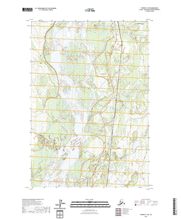
2023 Map of Tyonek D-1 NE
USGS Topo · Published 2023About this map
The Susitna River and its complex braided channels dominate this Matanuska-Susitna Borough landscape, where the Parks Highway corridor serves as the primary artery for recent settlement. North of Willow, a grid of residential drives and rural roads, including Sisson Road and Martin Drive, has expanded into the lowland forests and wetlands between the main river and the Kashwitna River. This 2023 edition details the infrastructure of these remote communities, noting the Rustic Wilderness Airport and specialized access routes like Susitna Landing Road. The map tracks the numbered tributaries of the region, such as 191 Mile Creek and 193 1/2 Mile Creek, which follow the railroad-aligned naming conventions common to this stretch of the Alaskan interior. To the north, the community of Susitna North sits near Sheep Creek and the intersection of Caswell Lakes Road.
Find a feature on this map
35 named features on this map. Tap any name to fly to it.
Don’t see what you’re looking for? This feature index may not catch every label — zoom into the map to look around manually.
Map Details
Editions of this 2023 Tyonek D-1 NE Map
This is the sole edition of this map. No revisions or reprints were ever made.
Other maps of this area

1949 · Tyonek
USGS Topo · 1:250,000

1949 · Anchorage D-8
USGS Topo · 1:63,360

1950 · Talkeetna Mountains
USGS Topo · 1:250,000

1950 · Talkeetna
USGS Topo · 1:250,000

1950 · Talkeetna Mountains A-6
USGS Topo · 1:63,360

1951 · Talkeetna
USGS Topo · 1:250,000

1951 · Anchorage
USGS Topo · 1:250,000

1951 · Tyonek
USGS Topo · 1:250,000

1951 · Anchorage D-8
USGS Topo · 1:63,360

1952 · Tyonek D-1
USGS Topo · 1:63,360