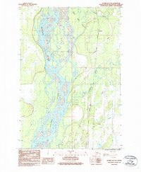
1987 Map of Tyonek D-1 NE
USGS Topo · Published 1987About this map
The Susitna River dominates this landscape, its complex braided channels and islands carving through the Matanuska-Susitna region during the 1980s. Parallel to the water, The Alaska Railroad serves as the primary corridor for movement, marked by precise milepost indicators such as 196 Mile and 197 1/2 Mile. The settlement of Caswell sits along this rail line, positioned where the terrain transitions toward the water-rich bottomlands of Sheep Creek Slough. Significant hydrologic features like the Kashwitna River and Sheep Creek converge toward the Susitna, creating a network of riparian channels. A Gravel Pit near the railroad suggests local industrial activity or infrastructure maintenance within this riverine environment. The map captures a specific moment in the development of the rail-and-river economy in south-central Alaska.
Find a feature on this map
13 named features on this map. Tap any name to fly to it.
Don’t see what you’re looking for? This feature index may not catch every label — zoom into the map to look around manually.
Map Details
Editions of this 1987 Tyonek D-1 NE Map
This is the sole edition of this map. No revisions or reprints were ever made.
Other maps of this area

1949 · Tyonek
USGS Topo · 1:250,000

1949 · Anchorage D-8
USGS Topo · 1:63,360

1950 · Talkeetna Mountains
USGS Topo · 1:250,000

1950 · Talkeetna
USGS Topo · 1:250,000

1950 · Talkeetna Mountains A-6
USGS Topo · 1:63,360

1951 · Talkeetna
USGS Topo · 1:250,000

1951 · Anchorage
USGS Topo · 1:250,000

1951 · Tyonek
USGS Topo · 1:250,000

1951 · Anchorage D-8
USGS Topo · 1:63,360

1952 · Tyonek D-1
USGS Topo · 1:63,360