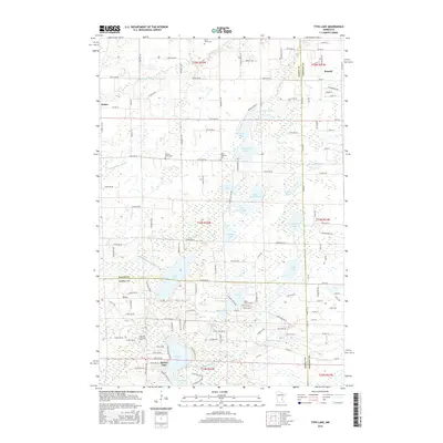
2016 Map of Typo Lake
USGS Topo · Published 2016About this map
Typo Lake and the marshy basins of the Anoka Sand Plain define this landscape at the intersection of Isanti, Chisago, and Anoka counties. The area is characterized by a dense concentration of glacial water bodies, including Martin Lake, Fawn Lake, and the expansive Tamarack Lake, all connected by the branching network of the Sunrise River system. The West Branch, North Branch, and W Br Sunrise River meander through low-lying terrain, creating a complex drainage pattern that has historically shaped local land use and road placement.
Find a feature on this map
140 named features on this map. Tap any name to fly to it.
Don’t see what you’re looking for? This feature index may not catch every label — zoom into the map to look around manually.
Map Details
Editions of this 2016 Typo Lake Map
This is the sole edition of this map. No revisions or reprints were ever made.
Other maps of this area

1950 · Rush City
USGS Topo · 1:48,000

1953 · Stillwater
USGS Topo · 1:250,000

1955 · Rush City
USGS Topo · 1:62,500

1955 · Forest Lake
USGS Topo · 1:62,500

1955 · Isanti
USGS Topo · 1:62,500

1955 · Stillwater
USGS Topo · 1:250,000

1958 · Stillwater
USGS Topo · 1:250,000

1961 · Cambridge
USGS Topo · 1:62,500

1965 · Stillwater
USGS Topo · 1:250,000
1974 · Stacy
USGS Topo · 1:24,000