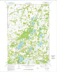
1974 Map of Typo Lake
USGS Topo · Published 1976About this map
Typo Lake and the surrounding marshlands of East Central Minnesota dominate this mid-1970s landscape, reflecting a region defined by its glacial hydrology and agricultural drainage systems. The intricate network of the Sunrise River, including its North Branch and West Branch, is heavily managed through engineering projects like Judicial Ditch No 2 and County Ditch No 13. These features indicate the historical effort to reclaim wetlands for productive use while maintaining the water table for the numerous basins such as Martin Lake and Horseshoe Lake.
Find a feature on this map
41 named features on this map. Tap any name to fly to it.
Don’t see what you’re looking for? This feature index may not catch every label — zoom into the map to look around manually.
Map Details
Editions of this 1974 Typo Lake Map
This is the sole edition of this map. No revisions or reprints were ever made.
Other maps of this area

1950 · Rush City
USGS Topo · 1:48,000

1953 · Stillwater
USGS Topo · 1:250,000

1955 · Rush City
USGS Topo · 1:62,500

1955 · Forest Lake
USGS Topo · 1:62,500

1955 · Isanti
USGS Topo · 1:62,500

1955 · Stillwater
USGS Topo · 1:250,000

1958 · Stillwater
USGS Topo · 1:250,000

1961 · Cambridge
USGS Topo · 1:62,500

1965 · Stillwater
USGS Topo · 1:250,000
1974 · Stacy
USGS Topo · 1:24,000