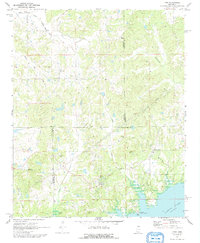
1971 Map of Tyro
USGS Topo · Published 1992About this map
The borderlands between Tate, Marshall, Lafayette, and Panola Counties define this rural Mississippi landscape as it appeared in the early 1970s. The northern reaches of Sardis Lake dominate the southern portion of the sheet, where the Teckville Public Use Area and a Boat Ramp mark the transition from agricultural land to the controlled inundation area. The settlement of Tyro serves as a central hub in the northern hills, surrounded by several family-named burial grounds including Mt Patient Cem and Waldrip Cem.
Find a feature on this map
30 named features on this map. Tap any name to fly to it.
Don’t see what you’re looking for? This feature index may not catch every label — zoom into the map to look around manually.
Map Details
Editions of this 1971 Tyro Map
2 editions found
Other maps of this area

1940 · Oxford
USGS Topo · 1:62,500

1943 · Oxford
USGS Topo · 1:62,500

1944 · Senatobia
USGS Topo · 1:62,500

1944 · Tyro
USGS Topo · 1:62,500

1952 · Sardis
USGS Topo · 1:62,500

1953 · Sardis
USGS Topo · 1:62,500

1956 · Tupelo
USGS Topo · 1:250,000

1958 · Tupelo
USGS Topo · 1:250,000
1971 · Marianna
USGS Topo · 1:24,000

1971 · Wyatte
USGS Topo · 1:24,000