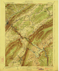
1923 Map of Tyrone
USGS Topo · Published 1923About this map
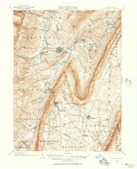
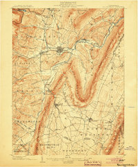
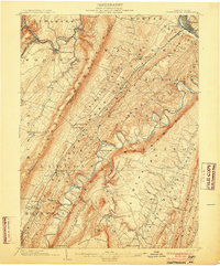
Tyrone serves as the industrial and transportation nexus where the Little Juniata River cuts through the ridges of central Pennsylvania. The 1921 survey reveals a landscape defined by the legacies of early iron production and complex hydraulics, evidenced by the presence of Huntingdon Furnace and Pennsylvania Furnace, alongside the enduring path of the Frankstown Branch Pennsylvania Canal. The intricate network of the Pennsylvania Railroad follows the natural corridors of the Bald Eagle Valley, connecting numerous small settlements like Ironville, Warriorsmark, and Petersburg.
Find a feature on this map
114 named features on this map. Tap any name to fly to it.
Don’t see what you’re looking for? This feature index may not catch every label — zoom into the map to look around manually.
Map Details
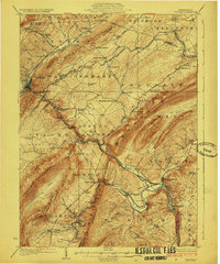
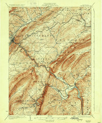
Editions of this 1923 Tyrone Map
4 editions found

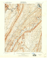
Other maps of this area
1901 · Huntingdon
USGS Topo · 1:62,500
1902 · Hollidaysburg
USGS Topo · 1:62,500
1903 · Hollidaysburg
USGS Topo · 1:62,500

1903 · Houtzdale
USGS Topo · 1:62,500
1904 · Huntingdon
USGS Topo · 1:62,500

1905 · Houtzdale
USGS Topo · 1:62,500

1908 · Bellefonte
USGS Topo · 1:62,500

1909 · Bellefonte
USGS Topo · 1:62,500

1919 · Menno
USGS Topo · 1:62,500

1920 · Altoona
USGS Topo · 1:62,500