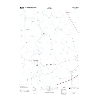
2013 Map of Tyrone
USGS Topo · Published 2013About this map
The Kentucky River carves a deep winding path through the Bluegrass landscape, defining the settlement patterns of Tyrone and Clifton in this 2013 survey. The river's influence is evident in landmarks like Lock Hollow and the massive Blackburn Memorial Bridge, which provides a vital link across the limestone palisades. The geography is marked by distinctive bends and bluffs, including Germany Bend, Lovers Leap, and the prominent Kentucky Bluff. Small crossroads communities such as Milner and McKees Crossroads dot the uplands, connected by a network of rural roads that often lead to historic river crossings like Whites Ferry Rd and Watts Ferry Rd. The presence of small landing strips such as Buzzard's Roost Airport and Seldom Scene Airport highlights the mix of traditional agriculture and modern private aviation in Anderson and Woodford counties. Numerous small tributaries, including Griers Cr and Glenns Cr, feed into the main river channel, shaping the rolling terrain around Mile Hill.
Find a feature on this map
76 named features on this map. Tap any name to fly to it.
Don’t see what you’re looking for? This feature index may not catch every label — zoom into the map to look around manually.
Map Details
Editions of this 2013 Tyrone Map
This is the sole edition of this map. No revisions or reprints were ever made.
Other maps of this area

1905 · Harrodsburg
USGS Topo · 1:125,000

1906 · Georgetown
USGS Topo · 1:62,500

1908 · Georgetown
USGS Topo · 1:62,500

1922 · Frankfort
USGS Topo · 1:48,000

1924 · Frankfort
USGS Topo · 1:62,500

1951 · Lawrenceburg
USGS Topo · 1:24,000

1952 · Keene
USGS Topo · 1:24,000

1952 · Salvisa
USGS Topo · 1:24,000

1952 · Mc Brayer
USGS Topo · 1:24,000

1952 · Midway
USGS Topo · 1:24,000