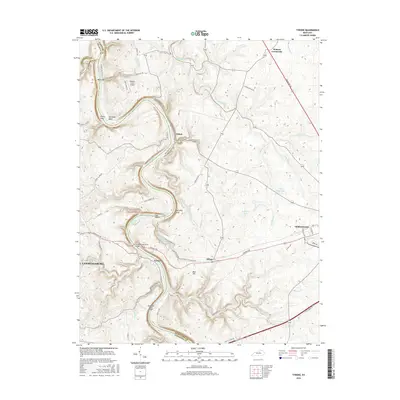
2016 Map of Tyrone
USGS Topo · Published 2016About this map
The Kentucky River carves a dramatic serpentine path through this Bluegrass region, defining the borders between Anderson, Woodford, and Franklin counties. Near the river crossing at Tyrone, the Blackburn Memorial Bridge serves as a critical transit point, while the local geography is marked by high elevations like Kentucky Bluff and Mile Hill. The settlement patterns here follow the ridges and river bends, with small communities such as Clifton and Milner connected by historical routes like the Tyrone Pike.
Find a feature on this map
69 named features on this map. Tap any name to fly to it.
Don’t see what you’re looking for? This feature index may not catch every label — zoom into the map to look around manually.
Map Details
Editions of this 2016 Tyrone Map
This is the sole edition of this map. No revisions or reprints were ever made.
Other maps of this area

1905 · Harrodsburg
USGS Topo · 1:125,000

1906 · Georgetown
USGS Topo · 1:62,500

1908 · Georgetown
USGS Topo · 1:62,500

1922 · Frankfort
USGS Topo · 1:48,000

1924 · Frankfort
USGS Topo · 1:62,500

1951 · Lawrenceburg
USGS Topo · 1:24,000

1952 · Keene
USGS Topo · 1:24,000

1952 · Salvisa
USGS Topo · 1:24,000

1952 · Mc Brayer
USGS Topo · 1:24,000

1952 · Midway
USGS Topo · 1:24,000