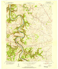
1954 Map of Tyrone
USGS Topo · Published 1955About this map
The Kentucky River carves a deep, serpentine path through this 1954 survey of Woodford, Anderson, and Franklin counties. The river's dramatic oxbows dominate the landscape, marked by industrial and navigational points like Lock No 5 and a Pumping Sta. The settlement of Tyrone sits at a critical bend where the Southern railroad line crosses the water, connecting the river economy to the interior. Further inland, the map captures a rural network of limestone-soil farms and small community centers such as Milner and Clifton. Cultural landmarks like Glenns Creek Ch and Georgetown Sch anchor the uplands, while natural features like Lovers Leap overlook the valley. The map reveals the intricate drainage system feeding the main river, including Glenns Creek, Grier Creek, and Wildcat Creek, illustrating how the terrain dictated the placement of early routes like Scotts Ferry Road.
Find a feature on this map
34 named features on this map. Tap any name to fly to it.
Don’t see what you’re looking for? This feature index may not catch every label — zoom into the map to look around manually.
Map Details
Editions of this 1954 Tyrone Map
This is the sole edition of this map. No revisions or reprints were ever made.
Other maps of this area

1905 · Harrodsburg
USGS Topo · 1:125,000

1906 · Georgetown
USGS Topo · 1:62,500

1908 · Georgetown
USGS Topo · 1:62,500

1922 · Frankfort
USGS Topo · 1:48,000

1924 · Frankfort
USGS Topo · 1:62,500

1951 · Lawrenceburg
USGS Topo · 1:24,000

1952 · Keene
USGS Topo · 1:24,000

1952 · Salvisa
USGS Topo · 1:24,000

1952 · Mc Brayer
USGS Topo · 1:24,000

1952 · Midway
USGS Topo · 1:24,000