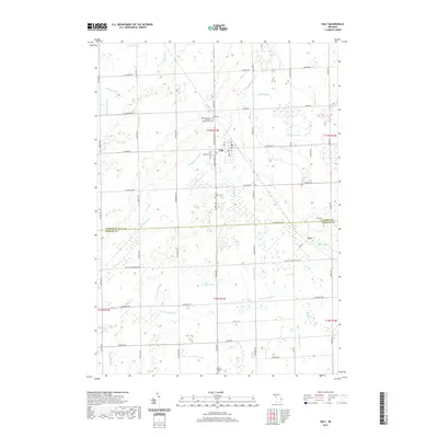
2019 Map of Ubly
USGS Topo · Published 2019About this map
The village of Ubly serves as the focal point of this Huron County landscape, situated at the intersection of several local drainages and early road networks. The terrain is defined by the headwaters and branches of the Cass River system, including the N Br Cass River and the S Fork Cass River. The rural character of the region is punctuated by numerous family-named drains and branches like the Osentoski Br, Humphrey Drain, and Schiestel Drain, illustrating the importance of agricultural water management in this part of Michigan. Genealogists will find a concentration of local history at sites such as Saint John the Evangelist Catholic Cem and the nearby Valley Cem. Further south, the settlement of Tyre marks the boundary between Huron and Sanilac Counties, surrounded by landmarks like the Tyre Cem and Mount Pleasant Cem.
Find a feature on this map
75 named features on this map. Tap any name to fly to it.
Don’t see what you’re looking for? This feature index may not catch every label — zoom into the map to look around manually.
Map Details
Editions of this 2019 Ubly Map
This is the sole edition of this map. No revisions or reprints were ever made.
Other maps of this area

1954 · Flint
USGS Topo · 1:250,000

1958 · Flint
USGS Topo · 1:250,000

1963 · New Greenleaf
USGS Topo · 1:24,000

1963 · Ubly
USGS Topo · 1:24,000

1963 · Minden City
USGS Topo · 1:24,000

1963 · Palms
USGS Topo · 1:24,000

1963 · Shabbona
USGS Topo · 1:24,000

1963 · Argyle
USGS Topo · 1:24,000

1970 · Bad Axe West
USGS Topo · 1:24,000

1970 · Bad Axe SE
USGS Topo · 1:24,000