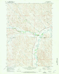
1970 Map of Ucross
USGS Topo · Published 1973About this map
Piney Creek and Clear Creek define the central valley of this northern Wyoming landscape, where an extensive network of irrigation infrastructure supports the regional ranching economy. The settlement of Ucross sits at the confluence of these waters, serving as a focal point for the surrounding agricultural community. The map reveals the intricate management of water in an arid environment, documenting numerous named channels such as the Pratt and Ferris Ditch, Athorpe Rogers Ditch, and Big Bonanza Ditch. These man-made features weave through the terrain alongside natural drainages like Bourret Draw and Coal Draw. The boundary between Sheridan and Johnson counties bisects the quadrangle, which is also marked by topographical landmarks like Blazer Hill and the Gaging Sta near the creeks. A complex of ranch roads and a Jeep Trail provide access across the varied draws and ridges of the high plains.
Find a feature on this map
30 named features on this map. Tap any name to fly to it.
Don’t see what you’re looking for? This feature index may not catch every label — zoom into the map to look around manually.
Map Details
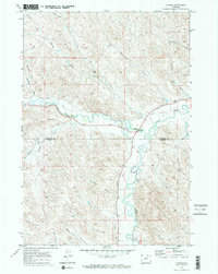
Editions of this 1970 Ucross Map
2 editions found
Other maps of this area

1900 · Fort McKinney
USGS Topo · 1:125,000

1903 · Fort McKinney
USGS Topo · 1:125,000

1909 · Sheridan
USGS Topo · 1:125,000

1911 · Sheridan
USGS Topo · 1:125,000

1955 · Sheridan
USGS Topo · 1:250,000

1958 · Sheridan
USGS Topo · 1:250,000

1962 · Sheridan
USGS Topo · 1:250,000

1970 · Buffalo NE
USGS Topo · 1:24,000
1970 · Horse Hill
USGS Topo · 1:24,000
1970 · Verona
USGS Topo · 1:24,000