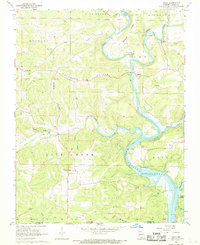
1968 Map of Udall
USGS Topo · Published 1969About this map
North Fork River winds through the hills of Ozark County, Missouri, just before the state line as it flows into the rising waters of Norfork Lake. This late 1960s survey documents the rural character of the region, showing the convergence of Bryant Creek and the river near Tecumseh, where a Boat Ramp and Picnic Area highlight the area's recreational transition. Genealogists can trace family footprints at Sallee Cem, Parker Cem, and Fay Cem, or locate community centers like Howards Ch and Our Saviors Ch near the settlement of Howards Ridge. Further north, the historic industrial site of Dawt Mill stands near the small community of Dawt, reflecting the water-powered history of the Missouri Ozarks before the landscape was heavily altered by modern infrastructure.
Find a feature on this map
48 named features on this map. Tap any name to fly to it.
Don’t see what you’re looking for? This feature index may not catch every label — zoom into the map to look around manually.
Map Details
Editions of this 1968 Udall Map
2 editions found
Other maps of this area

1890 · Mountain Home
USGS Topo · 1:125,000

1891 · Mountain Home
USGS Topo · 1:125,000

1894 · Mountain Home
USGS Topo · 1:125,000

1934 · Gainesville
USGS Topo · 1:48,000

1940 · Gainesville
USGS Topo · 1:62,500

1944 · Cureall
USGS Topo · 1:62,500

1945 · Harrison
USGS Topo · 1:250,000

1946 · Cureall
USGS Topo · 1:62,500

1949 · Harrison
USGS Topo · 1:250,000

1954 · Harrison
USGS Topo · 1:250,000