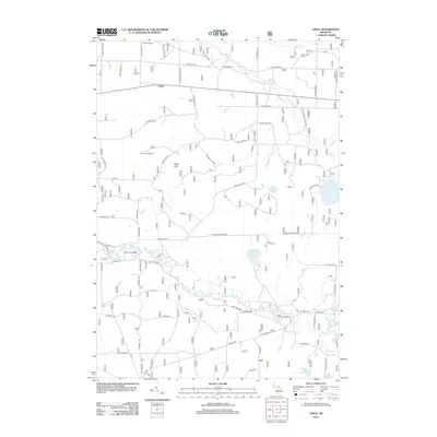
2012 Map of Udell
USGS Topo · Published 2012About this map
The Little Manistee River meanders across this landscape, defining the southern valley below the elevated terrain of the Udell Hills. This 2012 survey reveals a transition between the dense forest management of the northern reaches and the rural development clustered around the settlement of Udell. Historical landmarks like the Udell Lookout Tower and the Glenoak School sit among a network of Forest Service trails and county roads, reflecting the area's long-standing use for timber and fire management. To the south, the river provides a focal point for recreation at the Bear Track Campground and the small settlement of Ninemile Bridge. The map is punctuated by numerous small water bodies, including Lake of the Woods, Timmerman Lake, and several secluded basins like Buckwheat List Lake and Pomeroy Lakes, which characterize the glacial topography of Manistee County.
Find a feature on this map
70 named features on this map. Tap any name to fly to it.
Don’t see what you’re looking for? This feature index may not catch every label — zoom into the map to look around manually.
Map Details
Editions of this 2012 Udell Map
This is the sole edition of this map. No revisions or reprints were ever made.
Other maps of this area

1931 · Freesoil SW
USGS Topo · 1:31,680

1932 · Freesoil SE
USGS Topo · 1:31,680

1933 · Peacock SW
USGS Topo · 1:31,680

1933 · Peacock NW
USGS Topo · 1:31,680

1954 · Traverse City
USGS Topo · 1:250,000

1954 · Manitowoc
USGS Topo · 1:250,000

1956 · Onekama
USGS Topo · 1:62,500

1957 · Freesoil
USGS Topo · 1:62,500

1957 · Copemish
USGS Topo · 1:62,500

1957 · Wellston
USGS Topo · 1:62,500