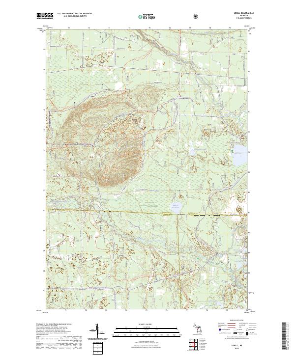
2023 Map of Udell
USGS Topo · Published 2023About this map
Udell Hills dominate this portion of the Manistee National Forest, where the landscape is defined by glacial terrain and a complex network of wetlands and small kettle lakes. This modern 2023 survey illustrates the northern Michigan wilderness across the intersection of Manistee, Mason, and Lake counties. The Little Manistee River meanders through the southern half of the map, fed by numerous seasonal drainages and surrounding water bodies like Lake of the Woods and the Pomeroy Lakes. To the north, the small settlement of Udell sits near the headwaters of Pine Creek. The intricate road system, including Nine Mile Bridge Rd and Steinburg Rd, provides access to these forested uplands, highlighting the area's significance for timber management and outdoor recreation. Large features like Hoppers Swamp and Timmerman Lake reflect the high water table that characterizes this woodland environment.
Find a feature on this map
91 named features on this map. Tap any name to fly to it.
Don’t see what you’re looking for? This feature index may not catch every label — zoom into the map to look around manually.
Map Details
Editions of this 2023 Udell Map
This is the sole edition of this map. No revisions or reprints were ever made.
Other maps of this area

1931 · Freesoil SW
USGS Topo · 1:31,680

1932 · Freesoil SE
USGS Topo · 1:31,680

1933 · Peacock SW
USGS Topo · 1:31,680

1933 · Peacock NW
USGS Topo · 1:31,680

1954 · Traverse City
USGS Topo · 1:250,000

1954 · Manitowoc
USGS Topo · 1:250,000

1956 · Onekama
USGS Topo · 1:62,500

1957 · Freesoil
USGS Topo · 1:62,500

1957 · Copemish
USGS Topo · 1:62,500

1957 · Wellston
USGS Topo · 1:62,500