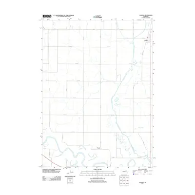
2011 Map of Uehling
USGS Topo · Published 2011About this map
Uehling sits in the northeast corner of this agricultural landscape, where the town grid meets the southern reaches of Dry Creek. The terrain is defined by the managed drainage of the Logan Creek Dredge, which cuts a straight line through the valley before meeting the meandering curves of the Elkhorn River in the south. This confluence of natural river bends and modern dredging projects illustrates the long-term engineering of the Nebraska plains to support the expansive field system visible today.
Find a feature on this map
34 named features on this map. Tap any name to fly to it.
Don’t see what you’re looking for? This feature index may not catch every label — zoom into the map to look around manually.
Map Details
Editions of this 2011 Uehling Map
This is the sole edition of this map. No revisions or reprints were ever made.
Other maps of this area

1955 · Fremont
USGS Topo · 1:250,000

1957 · Fremont
USGS Topo · 1:250,000

1958 · Fremont
USGS Topo · 1:250,000

1966 · Scribner SW
USGS Topo · 1:24,000

1966 · Oakland
USGS Topo · 1:24,000

1966 · West Point SE
USGS Topo · 1:24,000

1966 · Uehling
USGS Topo · 1:24,000

1966 · Nickerson
USGS Topo · 1:24,000

1966 · Hooper
USGS Topo · 1:24,000

1966 · Scribner
USGS Topo · 1:24,000