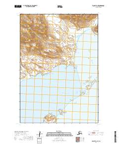
2019 Map of Ugashik B-1 NW
USGS Topo · Published 2019About this map
The mountain peaks of the Aleutian Range dominate the northwestern portion of this coastal survey, where steep terrain drops toward the waters of the Pacific Ocean. This is a landscape defined by maritime features, centered on the sheltered expanse of Wide Bay. The shoreline is punctuated by Coal Point, while a series of significant landforms, including West Channel Island, East Channel Island, and the prominent Terrace Island, create a complex archipelago within the bay.
Find a feature on this map
14 named features on this map. Tap any name to fly to it.
Don’t see what you’re looking for? This feature index may not catch every label — zoom into the map to look around manually.
Map Details
Editions of this 2019 Ugashik B-1 NW Map
This is the sole edition of this map. No revisions or reprints were ever made.
Other maps of this area

1943 · Ugashik
USGS Topo · 1:250,000

1948 · Ugashik
USGS Topo · 1:250,000

1949 · Ugashik
USGS Topo · 1:250,000

1951 · Ugashik B-1
USGS Topo · 1:63,360

1951 · Ugashik C-1
USGS Topo · 1:63,360

1951 · Ugashik C-2
USGS Topo · 1:63,360

1951 · Ugashik B-2
USGS Topo · 1:63,360

1963 · Ugashik
USGS Topo · 1:250,000
2019 · Ugashik C-2 SE
USGS Topo · 1:25,000

2019 · Ugashik B-1 SE
USGS Topo · 1:25,000