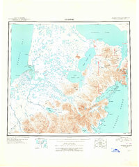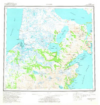
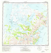
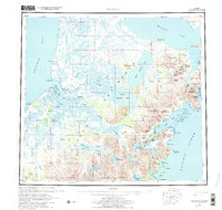
1963 Map of Ugashik
USGS Topo · Published 1968About this map
The Alaska Peninsula shoreline and volcanic interior are documented here during a period of mid-century mapping, capturing the sparse settlement pattern along Bristol Bay and the Pacific Ocean. Permanent coastal outposts like Pilot Point and Ugashik serve as anchors for the region's maritime activity, while the interior is defined by a massive complex of freshwater bodies including Becharof Lake and the connected Upper Ugashik Lake and Lower Ugashik Lake. This survey illustrates the vital relationship between the peninsula’s water systems and its geography, tracing the Dog Salmon River and King Salmon River as they drain into the bay. Significant geological landmarks like the volcanic Mount Peulik and the active Mount Chiginagak overlook a landscape marked by dramatic coastal features such as Cape Greig and the sheltered waters of Wide Bay.
Find a feature on this map
93 named features on this map. Tap any name to fly to it.
Don’t see what you’re looking for? This feature index may not catch every label — zoom into the map to look around manually.
Map Details
Editions of this 1963 Ugashik Map
3 editions found
Historical Maps of Pilot Point Through Time
4 maps found