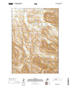
2019 Map of Ugashik C-2 SE
USGS Topo · Published 2019About this map
The boundary between the Lake and Peninsula Borough and Kodiak Island Borough cuts through this remote stretch of the Alaska Peninsula. Defined by a drainage network of glacial and snow-fed streams, the landscape is dominated by the upper reaches of Crooked Creek and Moore Creek. The topographic survey captures the high-elevation terrain where Des Moines Creek originates, illustrating a wilderness shaped by extreme relief and water movement before these tributaries join larger coastal systems. This map serves as a primary record of the hydrography within the t30s r44w and t31s r44w townships, showing the precise flow of Big Creek across the southeastern corner of the quadrangle.
Find a feature on this map
8 named features on this map. Tap any name to fly to it.
Don’t see what you’re looking for? This feature index may not catch every label — zoom into the map to look around manually.
Map Details
Editions of this 2019 Ugashik C-2 SE Map
This is the sole edition of this map. No revisions or reprints were ever made.
Other maps of this area

1943 · Ugashik
USGS Topo · 1:250,000

1948 · Ugashik
USGS Topo · 1:250,000

1949 · Ugashik
USGS Topo · 1:250,000

1951 · Ugashik B-1
USGS Topo · 1:63,360

1951 · Ugashik C-1
USGS Topo · 1:63,360

1951 · Ugashik C-2
USGS Topo · 1:63,360

1951 · Ugashik B-2
USGS Topo · 1:63,360

1963 · Ugashik
USGS Topo · 1:250,000
2019 · Ugashik B-1 NW
USGS Topo · 1:25,000
2019 · Ugashik C-2 NE
USGS Topo · 1:25,000