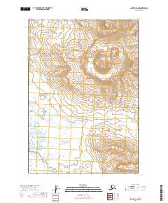
2019 Map of Ugashik C-2 NE
USGS Topo · Published 2019About this map
Aleutian Range foothills dominate this high-latitude terrain within the Lake and Peninsula Borough. The landscape is defined by the braided drainage patterns of Ugashik Cr, which flows westward across the coastal plain. In the northern reaches of the map, Hot Springs Cr descends from higher elevations to join the larger watershed, while Blue Cr cuts through the eastern sections. The presence of numerous wetland features and small kettle ponds across the lower elevations suggests a glaciated history, where meltwater from the range shaped the contemporary river valleys. This map provides a detailed view of these remote waterways before they reach the larger bays of the Alaskan peninsula.
Find a feature on this map
9 named features on this map. Tap any name to fly to it.
Don’t see what you’re looking for? This feature index may not catch every label — zoom into the map to look around manually.
Map Details
Editions of this 2019 Ugashik C-2 NE Map
This is the sole edition of this map. No revisions or reprints were ever made.
Other maps of this area

1943 · Ugashik
USGS Topo · 1:250,000

1948 · Ugashik
USGS Topo · 1:250,000

1949 · Ugashik
USGS Topo · 1:250,000

1951 · Ugashik D-1
USGS Topo · 1:63,360

1951 · Ugashik C-1
USGS Topo · 1:63,360

1951 · Ugashik C-2
USGS Topo · 1:63,360

1951 · Ugashik D-2
USGS Topo · 1:63,360

1963 · Ugashik
USGS Topo · 1:250,000
2019 · Ugashik C-2 SE
USGS Topo · 1:25,000
2019 · Ugashik D-1 SW
USGS Topo · 1:25,000