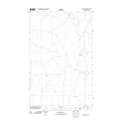
2011 Map of Uhlan Coulee
USGS Topo · Published 2011About this map
Porcupine Valley defines the southeastern portion of this map, where the winding Porcupine Creek is joined by tributary waters like Sargent Creek. This landscape is characterized by a network of drainage channels including Uhlan Coulee, Enright Coulee, and Johnson Coulee, which highlight the intricate hydraulic patterns of this part of Valley County. Human infrastructure in this rural area is represented by cattle-ranching and water-management features, most notably the Nyquist Number 2 Dam along the East Fork Cherry Creek. Named water sources such as Hermans Spring and Ericson Spring provide critical landmarks in a region largely defined by its natural geography and section-line roads like Geer Rd and Sargent Creek Rd.
Find a feature on this map
14 named features on this map. Tap any name to fly to it.
Don’t see what you’re looking for? This feature index may not catch every label — zoom into the map to look around manually.
Map Details
Editions of this 2011 Uhlan Coulee Map
This is the sole edition of this map. No revisions or reprints were ever made.
Other maps of this area

1914 · Nashua
USGS Topo · 1:62,500

1916 · Nashua
USGS Topo · 1:62,500

1918 · Porcupine Valley
USGS Topo · 1:62,500

1943 · Glasgow
USGS Topo · 1:125,000

1954 · Glasgow
USGS Topo · 1:250,000

1957 · Glasgow
USGS Topo · 1:250,000

1958 · Glasgow
USGS Topo · 1:250,000

1958 · Whately
USGS Topo · 1:24,000

1969 · Chapman Coulee NE
USGS Topo · 1:24,000

1969 · Hawk Coulee
USGS Topo · 1:24,000