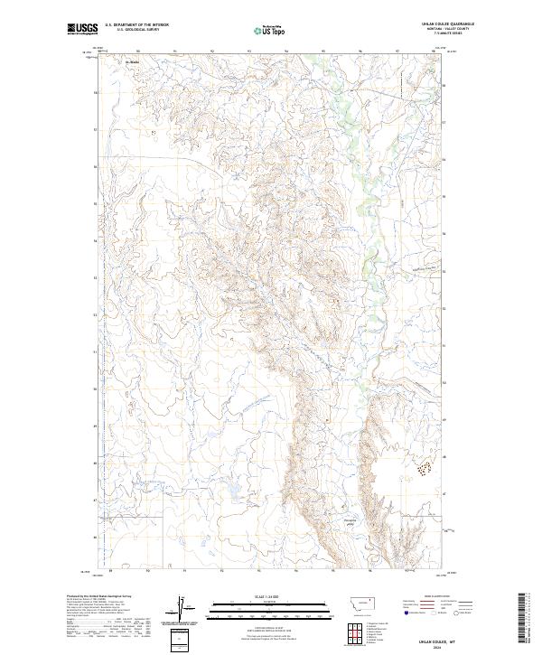
2024 Map of Uhlan Coulee
USGS Topo · Published 2024About this map
St. Marie sits at the northern edge of this high plains landscape, where the Missouri River watershed is defined by intricate drainage networks. The terrain is dominated by the deep incisions of Uhlan Coulee and Johnson Coulee, which channel seasonal runoff through the arid breaks of Valley County. To the south, the broad floor of Porcupine Valley provides a distinct contrast to the dissected uplands, fed by the winding courses of Porcupine Creek and the East Fork Cherry Creek. Scattered water sources like Hermans Spring and Ericson Spring represent vital landmarks in this prairie environment. The road network, including Nyquist Rd and Sargent Creek Rd, follows the section lines and natural contours, reflecting the persistent grid of the Public Land Survey System across the rural Montana interior.
Find a feature on this map
16 named features on this map. Tap any name to fly to it.
Don’t see what you’re looking for? This feature index may not catch every label — zoom into the map to look around manually.
Map Details
Editions of this 2024 Uhlan Coulee Map
This is the sole edition of this map. No revisions or reprints were ever made.
Other maps of this area

1914 · Nashua
USGS Topo · 1:62,500

1916 · Nashua
USGS Topo · 1:62,500

1918 · Porcupine Valley
USGS Topo · 1:62,500

1943 · Glasgow
USGS Topo · 1:125,000

1954 · Glasgow
USGS Topo · 1:250,000

1957 · Glasgow
USGS Topo · 1:250,000

1958 · Glasgow
USGS Topo · 1:250,000

1958 · Whately
USGS Topo · 1:24,000

1969 · Chapman Coulee NE
USGS Topo · 1:24,000

1969 · Hawk Coulee
USGS Topo · 1:24,000