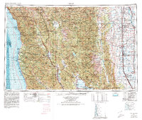
1957 Map of Ukiah
USGS Topo · Published 1980About this map
Round Valley Indian Reservation and the sprawling Mendocino National Forest anchor the center of this coastal and valley study, which transitions from the Pacific shoreline to the agricultural heart of the Sacramento Valley. The map details the rugged interior of the Coast Ranges, marked by peaks like Mount Sanhedrin and Hull Mountain, and the complex drainage systems of the Eel River and Russian River. In the east, the intensive irrigation and settlement patterns of the valley are evident near Willows and Colusa, where the Sacramento National Wildlife Refuge and Colusa National Wildlife Refuge sit alongside the winding Sacramento River.
Find a feature on this map
126 named features on this map. Tap any name to fly to it.
Don’t see what you’re looking for? This feature index may not catch every label — zoom into the map to look around manually.
Map Details
Editions of this 1957 Ukiah Map
3 editions found

Other maps of this area

1886 · Lassen Peak
USGS Topo · 1:250,000

1888 · Marysville
USGS Topo · 1:125,000

1890 · Red Bluff
USGS Topo · 1:250,000

1891 · Chico
USGS Topo · 1:125,000

1891 · Marysville
USGS Topo · 1:125,000

1892 · Lassen Peak
USGS Topo · 1:250,000

1893 · Chico
USGS Topo · 1:125,000

1894 · Lassen Peak
USGS Topo · 1:250,000

1894 · Marysville
USGS Topo · 1:125,000

1894 · Red Bluff
USGS Topo · 1:250,000