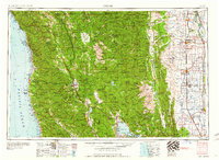
1960 Map of Ukiah
USGS Topo · Published 1960About this map
Ukiah and the surrounding Russian River valley anchor this mid-century look at the Northern California Coast Ranges. To the west, the coastline is dotted with timber and fishing ports like Fort Bragg, Noyo, and Caspar, while the Jackson State Forest provides a buffer between the shoreline and the interior mountains. This survey captures the region just as the 1957 road network was being finalized, showing the path of Us 101 as it winds through the redwoods and hills. The map highlights the vast Mendocino National Forest and the agricultural pocket of Round Valley near Covelo. To the east, the landscape transitions into the Sacramento Valley, dominated by the waters of Clear Lake and the organized irrigation of the Sacramento River basin, including the Sacramento National Wildlife Refuge and Colusa National Wildlife Refuge.
Find a feature on this map
120 named features on this map. Tap any name to fly to it.
Don’t see what you’re looking for? This feature index may not catch every label — zoom into the map to look around manually.
Map Details
Editions of this 1960 Ukiah Map
2 editions found

Other maps of this area

1886 · Lassen Peak
USGS Topo · 1:250,000

1888 · Marysville
USGS Topo · 1:125,000

1890 · Red Bluff
USGS Topo · 1:250,000

1891 · Chico
USGS Topo · 1:125,000

1891 · Marysville
USGS Topo · 1:125,000

1892 · Lassen Peak
USGS Topo · 1:250,000

1893 · Chico
USGS Topo · 1:125,000

1894 · Lassen Peak
USGS Topo · 1:250,000

1894 · Marysville
USGS Topo · 1:125,000

1894 · Red Bluff
USGS Topo · 1:250,000