
1960 Map of Ukiah
USGS Topo · Published 1960About this map
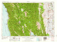
The Round Valley Indian Reservation and the extensive Mendocino National Forest define the interior of this Northern California landscape, where the Eel River and its various forks carve through the Coast Ranges. Along the coastline, the California Western RR connects the timber hub of Fort Bragg to the interior, while the Northwestern Pacific RR follows the Russian River valley through Ukiah. This era captures the region prior to the full expansion of the modern highway system, emphasizing the importance of these rail corridors and coastal settlements like Mendocino and Albion. To the east, the terrain drops sharply into the Sacramento Valley, where the Southern Pacific RR serves agricultural centers like Colusa and Williams. The map also details the wetlands of the Colusa National Wildlife Refuge and the Sacramento National Wildlife Refuge, highlighting the contrast between the timber-rich mountains and the fertile valley floor.
Find a feature on this map
274 named features on this map. Tap any name to fly to it.
Don’t see what you’re looking for? This feature index may not catch every label — zoom into the map to look around manually.
Map Details
Editions of this 1960 Ukiah Map
2 editions found
Other maps of this area

1886 · Lassen Peak
USGS Topo · 1:250,000

1888 · Marysville
USGS Topo · 1:125,000

1890 · Red Bluff
USGS Topo · 1:250,000

1891 · Chico
USGS Topo · 1:125,000

1891 · Marysville
USGS Topo · 1:125,000

1892 · Lassen Peak
USGS Topo · 1:250,000

1893 · Chico
USGS Topo · 1:125,000

1894 · Lassen Peak
USGS Topo · 1:250,000

1894 · Marysville
USGS Topo · 1:125,000

1894 · Red Bluff
USGS Topo · 1:250,000