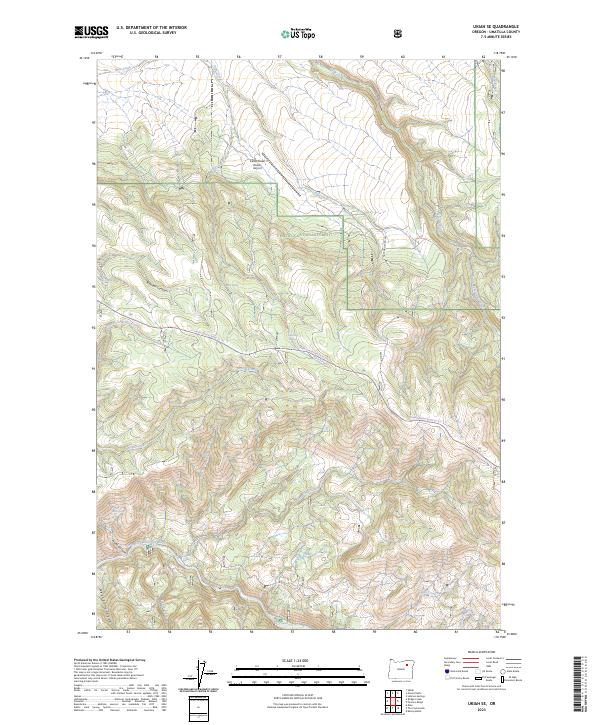
2023 Map of Ukiah SE
USGS Topo · Published 2023About this map
The North Fork John Day Wild and Scenic River corridor anchor the southern reaches of this landscape, where the North Fork John Day River carves through the terrain of the Umatilla National Forest. This protected wilderness area is defined by a complex network of drainages and springs, including the headwaters of Texas Bar Creek and the flow of Cable Creek. Near the northern boundary, the Cable Creek Ranch Airport stands as a rare modern landmark in an otherwise remote expanse of canyons and forest land.
Find a feature on this map
26 named features on this map. Tap any name to fly to it.
Don’t see what you’re looking for? This feature index may not catch every label — zoom into the map to look around manually.
Map Details
Editions of this 2023 Ukiah SE Map
This is the sole edition of this map. No revisions or reprints were ever made.
Other maps of this area

1951 · Dale
USGS Topo · 1:62,500

1951 · Desolation Butte
USGS Topo · 1:62,500

1953 · Pendleton
USGS Topo · 1:250,000

1955 · Canyon City
USGS Topo · 1:250,000

1956 · Pendleton
USGS Topo · 1:250,000

1959 · Canyon City
USGS Topo · 1:250,000

1967 · Ukiah SE
USGS Topo · 1:24,000

1967 · Lehman Springs
USGS Topo · 1:24,000

1967 · Pearson Ridge
USGS Topo · 1:24,000

1967 · Bridge Creek
USGS Topo · 1:24,000