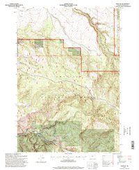
1995 Map of Ukiah SE
USGS Topo · Published 1998About this map
Umatilla National Forest dominates this landscape in the mid-1990s, defining a region where water sources are the primary named landmarks. The southwestern corner is anchored by the Bridge Creek State Wildlife Area, where the terrain drops sharply toward the North Fork John Day River. This river corridor and its adjacent canyons, including Hot Springs Canyon, suggest a landscape shaped by significant geological activity and hydraulic erosion.
Find a feature on this map
22 named features on this map. Tap any name to fly to it.
Don’t see what you’re looking for? This feature index may not catch every label — zoom into the map to look around manually.
Map Details
Editions of this 1995 Ukiah SE Map
This is the sole edition of this map. No revisions or reprints were ever made.
Other maps of this area

1951 · Dale
USGS Topo · 1:62,500

1951 · Desolation Butte
USGS Topo · 1:62,500

1953 · Pendleton
USGS Topo · 1:250,000

1955 · Canyon City
USGS Topo · 1:250,000

1956 · Pendleton
USGS Topo · 1:250,000

1959 · Canyon City
USGS Topo · 1:250,000

1967 · Ukiah SE
USGS Topo · 1:24,000

1967 · Lehman Springs
USGS Topo · 1:24,000

1967 · Pearson Ridge
USGS Topo · 1:24,000

1967 · Bridge Creek
USGS Topo · 1:24,000