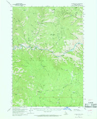
1960 Map of Ulysses Mtn
USGS Topo · Published 1969About this map
Mining and forestry define this remote Idaho landscape during the 1950s, centered on the drainage of the Salmon River. The settlement of Ulysses and the nearby Ulysses Mine and Kitty Burton Mine indicate the area's extraction history, with Tailings noted along the riverbank further downstream. Elevation is a dominant feature, monitored from high vantage points like Stormy Peak Lookout and Indian Lookout.
Find a feature on this map
82 named features on this map. Tap any name to fly to it.
Don’t see what you’re looking for? This feature index may not catch every label — zoom into the map to look around manually.
Map Details
Editions of this 1960 Ulysses Mtn Map
3 editions found

Other maps of this area

1950 · Blackbird Mtn
USGS Topo · 1:62,500

1950 · Salmon
USGS Topo · 1:62,500

1950 · Leesburg
USGS Topo · 1:62,500

1951 · Leesburg
USGS Topo · 1:62,500

1951 · Blackbird Mtn
USGS Topo · 1:62,500

1951 · Salmon
USGS Topo · 1:62,500

1955 · Dillon
USGS Topo · 1:250,000

1956 · Elk City
USGS Topo · 1:250,000

1957 · Dillon
USGS Topo · 1:250,000

1958 · Dillon
USGS Topo · 1:250,000