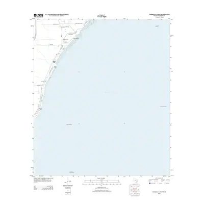
2013 Map of Umbrella Point
USGS Topo · Published 2013About this map
Beach City sits along the western edge of Trinity Bay, defining a coastal landscape where residential growth meets significant energy production. This 2013 survey illustrates the dense network of local roads such as Windy Oaks St and Point Barrow Rd that serve the shoreline communities. The area's heritage is preserved in small sites like Barrow Cem and Fisher Cem, which remain tucked between modern developments and the bay's edge.
Find a feature on this map
29 named features on this map. Tap any name to fly to it.
Don’t see what you’re looking for? This feature index may not catch every label — zoom into the map to look around manually.
Map Details
Editions of this 2013 Umbrella Point Map
This is the sole edition of this map. No revisions or reprints were ever made.
Other maps of this area

1916 · Morgan Point
USGS Topo · 1:24,000

1916 · Cedar Bayou
USGS Topo · 1:24,000

1919 · Morgan Point
USGS Topo · 1:31,680

1919 · Cedar Bayou
USGS Topo · 1:31,680

1932 · Clifton By The Sea
USGS Topo · 1:31,680

1933 · Whites Lake
USGS Topo · 1:31,680

1933 · Smith Point
USGS Topo · 1:31,680

1942 · Anahuac
USGS Topo · 1:24,000

1943 · West of Eagle
USGS Topo · 1:31,680
1943 · Morgan Point
USGS Topo · 1:31,680