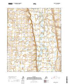
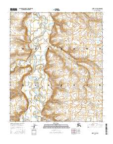
2017 Map of Umiat B-2 SW
USGS Topo · Published 2017About this map
The Anaktuvuk River dominates this Arctic landscape, its braided channels and shifting gravel bars weaving through a complex network of thaw lakes and wetlands. The terrain is characterized by the low-relief tundra of the North Slope, where drainage patterns are constantly influenced by the underlying permafrost. To the southeast, the Nanushuk River enters the frame, marking a point of convergence between these two significant glacial-fed waterways. This 2017 survey illustrates a remote wilderness defined by water and ice, where the lack of permanent roads or settlements reflects the extreme environment. The surveyor's grid, including t1s r4e, t1s r5e, t2s r4e, and t2s r5e, provides the only human-imposed structure over this expansive riverine system.
Find a feature on this map
6 named features on this map. Tap any name to fly to it.
Don’t see what you’re looking for? This feature index may not catch every label — zoom into the map to look around manually.
Map Details
Editions of this 2017 Umiat B-2 SW Map
This is the sole edition of this map. No revisions or reprints were ever made.
Other maps of this area

1952 · Umiat
USGS Topo · 1:250,000

1955 · Umiat A-3
USGS Topo · 1:63,360

1955 · Umiat B-3
USGS Topo · 1:63,360

1956 · Umiat
USGS Topo · 1:250,000

1964 · Umiat
USGS Topo · 1:250,000

1971 · Umiat A-2
USGS Topo · 1:63,360
1971 · Umiat B-2
USGS Topo · 1:63,360
2013 · Umiat B-3 NE
USGS Topo · 1:25,000
2016 · Umiat A-3 NE
USGS Topo · 1:25,000
2016 · Umiat B-3 SE
USGS Topo · 1:25,000