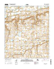
2016 Map of Umiat B-4 SE
USGS Topo · Published 2016About this map
The Colville River flows across the northern edge of this North Slope terrain, defining the upper bounds of a landscape shaped by glacial hydrology and permafrost processes. This 2016 survey captures the meandering course of the Kutchik River as it weaves through the southern and central sections, reflecting a riverine system characterized by high-latitude drainage patterns. The map details a remote wilderness where land is demarcated by township and range boundaries including t1s r1w and t1e r1e, highlighting the administrative grid that organizes this unsettled stretch of the Alaska interior. The absence of roads or permanent settlements underscores the isolation of this region, providing researchers a clear look at the natural topographical contours and seasonal water bodies before any modern human encroachment.
Find a feature on this map
6 named features on this map. Tap any name to fly to it.
Don’t see what you’re looking for? This feature index may not catch every label — zoom into the map to look around manually.
Map Details
Editions of this 2016 Umiat B-4 SE Map
This is the sole edition of this map. No revisions or reprints were ever made.
Other maps of this area

1952 · Umiat
USGS Topo · 1:250,000

1955 · Umiat B-4
USGS Topo · 1:63,360

1955 · Umiat A-4
USGS Topo · 1:63,360

1955 · Umiat A-3
USGS Topo · 1:63,360

1955 · Umiat B-3
USGS Topo · 1:63,360

1956 · Umiat
USGS Topo · 1:250,000

1964 · Umiat
USGS Topo · 1:250,000
2013 · Umiat B-3 NW
USGS Topo · 1:25,000
2016 · Umiat A-4 NW
USGS Topo · 1:25,000
2016 · Umiat A-3 NW
USGS Topo · 1:25,000